|
|
|
|
PLACE OF INTEREST
| State | Places of Interest | Nearest Railhead | | Assam | Kaziranga National Park | Furkating | | Majuli Island | Jorhat | | Ranghar, Talatal Ghar, Shiv Dol | Sibsagar Town | | Dibru-SaikhowaWild Life sanctuary | Tinsukia | | Tilinga Temple | Bordubi, Tinsukia | | Jeypore Rain forest, Namphake | Naharkatia | | Dilhi Ghat | Namrup | | Charaideo | Safrai | | Stillwell Road | Ledo | | Arunachal Pradesh | Namdapha National Park | New Tinsukia | | Parsuram Kund | New Tinsukia | | Mayodia pass | New Tinsukia | | Golden Pagoda, Namsai | New Tinsukia | | Pasighat | New Tinsukia | 1. Kaziranga National Park (Golaghat, Assam) Kaziranga National Park is a national park in the Golaghat, Karbi Anglong and Nagaon districts of the state of Assam, India. The sanctuary, which hosts two-thirds of the world's great one-horned rhinoceroses, is a World Heritage Site. According to the census held in March 2018 which was jointly conducted by the Forest Department of the Government of Assam and some recognized wildlife NGOs, the rhino population in Kaziranga National Park is 2,413. Kaziranga is home to the highest density of tigers among protected areas in the world, and was declared a Tiger Reserve in 2006 (now the highest tiger density is in Orang National Park, Assam). The park is home to large breeding populations of elephants, wild water buffalo, and swamp deer. Kaziranga is recognized as an Important Bird Area by BirdLife International for conservation of avifaunal species. When compared with other protected areas in India, Kaziranga has achieved notable success in wildlife conservation. Located on the edge of the Eastern Himalayabiodiversity hotspot, the park combines high species diversity and visibility. Kaziranga is a vast expanse of tall elephant grass, marshland, and dense tropical moist broadleaf forests, criss-crossed by four major rivers, including the Brahmaputra, and the park includes numerous small bodies of water. Kaziranga has been the theme of several books, songs, and documentaries. The park celebrated its centennial in 2005 after its establishment in 1905 as a reserve forest
2. Majuli River Island (Assam) Majuli, the largest river island in the world situated in the Brahmaputra River, Assam and in 2016 it became the first island to be made a district in India. It had an area of 880 km2 (340 sq mi) at the beginning of the 20th century, but having lost significantly to erosion it covers 352 square kilometres (136 sq mi) as at 2014. Majuli has shrunk as the river surrounding it has grown.
The island is formed by the Brahmaputra River in the south and the Kherkutia Xuti, a branch of the Brahmaputra, joined by the Subansiri River in the north. Majuli island is accessible by ferries from the city of Jorhat. The island is about 300–400 kilometres (186–249 mi) east from the state's largest city —Guwahati. It was formed due to course changes by the river Brahmaputra and its tributaries, mainly the Lohit. Majuli is the abode of the Assamese neo-Vaishnavite culture.
3. Sivasagar (Assam) Sivasagar district, formerly known as Sibsagar, is one of the 33 districts of Assamstate in Northeast India. Sivasgar was established by Ahoms. Before that at the early time, the area under the district was inhabited by the indigenous Tai and Tibeto-Burman tribes like Matak, Borahis and Morans. Before the British period, the center of administration of Assam was around Sivasagar were the famous Ahoms ruled for nearly six hundred years. The Ahom kings took keen interest in building different temples, dedicated to various deities and which were usually flanked by large tanks which till today stand out as memorials to their glory in the district. Sivasagar or Rongpur as it was known then, was the capital of the Ahom Kingdom from 1699 to 1788. The famous Joysagar Tank was excavated within 45 days by Rudra Singha (1696-1714) in memory of his mother Joymoti Kunwari. The Joy Dol is situated on the bank of the Joysagar Tank. Pramatta Singha (1744-1751) built the Ranghar with bricks in 1745. Gaurisagar Tank is situated at a distance of about eight miles from Sivasagar town. The Sivasagar Tank was excavated by queen Ambika Devi in 1733. The Siva Dol, Vishnu Dol and Devi Dol are situated on the bank of the Sivasagar Tank. Rajeshwar Singha (1751-1769) built the Kareng Ghar in Gargaon. Charaideo, about 28 kilometers away from Sivasagar is famous for a cluster of Maidams, the Ahom age tumuli. Sukapha, the first Ahom king, constructed his capital at Charaideo in 1253. Sivasagar was earlier known as Rongpur and Rongpur was earlier known as Meteka.   Ranghar Karenghar
J oysagar Sivadol
4. Dibru-Saikhowa National Park (Tinsukia, Assam)
Dibru-Saikhowa National Park is a national park in Assam, India, located in Dibrugarh and Tinsukia districts. It was designated a Biosphere Reserve in July 1997 with an area of 765 km2 (295 sq mi), including a core area of 340 km2 (130 sq mi) and a buffer zone of 425 km2 (164 sq mi).

It is located at about 12 km (7.5 mi) north of Tinsukia town at an average elevation of 118 m (387 ft), ranging from 110 to 126 m (361 to 413 ft). The park is bounded by the Brahmaputra and Lohit Rivers in the north and Dibru river in the south. It mainly consists of moist mixed semi-evergreen forests, moist mixed deciduous forests, canebrakes and grasslands. It is the largest salixswamp forest in north-eastern India, with a tropical monsoon climate with a hot and wet summer and cool and usually dry winter. Annual rainfall ranges from 2,300 to 3,800 mm (91 to 150 in). It is a haven for many endangered species and rich in fish diversity.
5. Tilinga Temple (Bordubi, Tinsukia, Assam) 
Tilinga Mandir or Bell temple is situated in the small town of Bordubi of Tinsukia district in Assam. The temple houses the deity of Lord Shiva. The Bell Temple is mystically and spiritually stronger than other temples. You will get to see hundreds and thousands of bells of all size here. The bells are made up of different metals such as bronze, brass, aluminum, copper and are tied to a huge Peepal tree. You will also find hundred Shiva tridents speared here and there in the sand carelessly. The temple is highly revered in the place because people here believe that wishes come true if one prays to Lord Shiva but after that you have to donate a bell in the temple. You can also present a pigeon, a trishul or a bell when your wishes are fulfilled. The temple is almost half a century old and it was said that the Shiva Linga emerged from the ground near a banyan tree which is there in the temple. People come to visit the place after that and prayed to the lord.
6. Jeypore Rain forest, Namphake (Dibrugarh, Assam)
Nature at it’s best, Jeypore Forest in Dibrugarh in the state of Assam is something that you cannot to afford to miss. Spread over an area of 108 sq. km, this forest is famous for its biodiversity and is full of various species of flora and fauna. It comes under world heritage of evergreen rain forest and it rains almost all throughout the year.
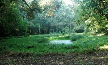
The forest has more than 102 species of orchids here along with a wide variety of animals and plants. Some of the common trees that are abundant in the forest are Ajar, Segun, Nahar, Bohot, and Sam. Hollong is the dominant species of trees here and these trees reach up to a height of 50 metres. Animals that can be seen in this forest are elephants, hornbills, leopards, flying squirrels, pythons, spotted deer, and langurs to name a few. Jeypore Rainforest covers a huge area and it takes a lot of time in exploring even the areas where tourists usually go.
7. Dilhi Ghat, A famous picnic spot (Namrup, Assam)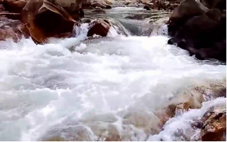
Dilighat is situated on the banks of river dilhi or disang (a tributary of mighty Luit or Brahmaputra) along Namrup and Borhat border. It has become a favoutite destination during winters for picnick lovers. The hanging bridge constructed over the river add to the regions wonder. Surrounded by greenery on all sides, the gurgling waters of the river make an excellent combination to offer tourists the much needed relaxation.The Dilihghat in Namrup is a famous picnic spot in Upper Assam. Namrup is a small town situated close to the foothills of the great Patkai Mountain Range
8. Charaideo Maidam, Safrai, Assam 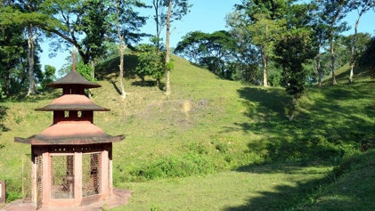
The maidams situated in Charaideo make the district an attractive tourist destination. Comparable to the pyramids of Egypt, the maidams are actually burial grounds of Ahom Kings and Queens. They are substances of wonder seen-through the brilliant architecture and expertise of the artsmen and masons of Assam of the medieval era. The district also boasts of ancient ruins and relics which add to its crowning glory.
9. Stillwell Road (Ledo, Assam) The Ledo Road (from Ledo, Assam, India to Kunming, Yunnan, China) was an overland connection between India and China, built during World War II to enable the Western Allies to deliver supplies to China and aid the war effort against Japan. After the Japanese cut off the Burma Road in 1942 an alternative was required, hence the construction of the Ledo road. It was renamed the Stilwell Road, after General Joseph Stilwell of the U.S. Army, in early 1945 at the suggestion of Chiang Kai-shek. It passes through the Burmese towns of Shingbwiyang, Myitkyina and Bhamo in Kachin state. Of the 1,726 kilometres (1,072 mi) long road, 1,033 kms (642 mi) are in Burma and 632 kms (393 mi) in China with the remainder in India. The road had the Ledo-Pangsau Pass-Tanai (Danai)-Myitkyina--Bhamo-Mansi-Namhkam-Kunming route. 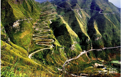
To move supplies from the railheads to the Army fronts three all weather roads were constructed in record time during the autumn (fall) of 1943:Ledo road in the north across 3 nations which went on to connect to the Burma road and supply China, the campaign winning Central Front road within India from Dimapur to Imphal, and the southern road from Dohazari south of Chittagong in British India for the advance of troops to Arakan in Myanmar.
10. Namdapha National Park (Changlang, Arunachal Pradesh) Namdapha National Park is a 1,985 km2 (766 sq mi) large protected area in Arunachal Pradesh of Northeast India. With more than 1,000 floral and about 1,400 faunal species, it is a biodiversity hotspot in the Eastern Himalayas. The national park harbours the northernmost lowland evergreen rainforests in the world at 27°N latitude. It also harbours extensive dipterocarp forests, comprising the northwestern parts of the Mizoram-Manipur-Kachin rain forests ecoregion. It is the fourth largest national park in India.
Sapria himalayana and Balanophora are root parasites related to Rafflesia recorded from the area. The Namdapha flying squirrel (Biswamoyopterus biswasi) was first collected in the park and described. It is endemic to the park and critically endangered. It was last recorded in 1981 in a single valley within the park. 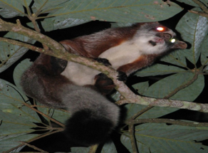
11. Parsuram Kund (Arunachal Pradesh) 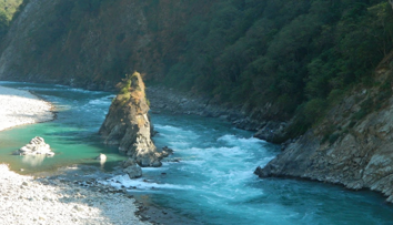 Parshuram Kund is a Hindu pilgrimage sites situated on the Brahmaputra plateau in the lower reaches of the Lohit River and 21 km north of Tezu in Lohit district of Arunachal Pradesh, India. Dedicated to sage Parshuram, the popular site attracts pilgrims from Nepal, from across India, and from nearby states of Manipur and Assam. Over 70,000 devotees and sadhus take a holy dip in its water each year on the occasion of Makar Sankranti, in the month of January.
12. Mayodia Pass (Arunachal Pradesh) Mayodia Pass is located about 56 km from Roing in Arunachal Pradesh, with an elevation of 2,655 m above sea level. "Mayodia" is a Deori-Chutia word which stands for "shrine of mother goddess", "Mayo" means "mother goddess", "Di" means "water" and "Ya" means "land". Nearest town is Roing (56 km).
Mayodia is a popular local tourist attraction due to the snow fall it receives during winters. Snowfall starts in November and continues until March, but heavy snowfall occurs between the month of January and February. 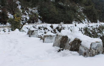
 Source : Welcome to North East Frontier Railway / Indian Railways Portal CMS Team Last Reviewed : 31-12-2020
|
|
|


